 Centralasia Adventures
+998712544100
Centralasia Adventures
+998712544100


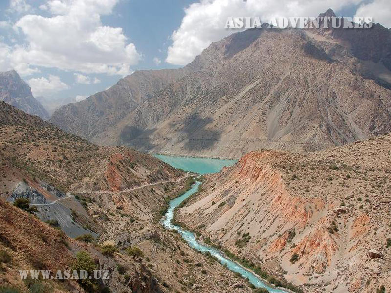
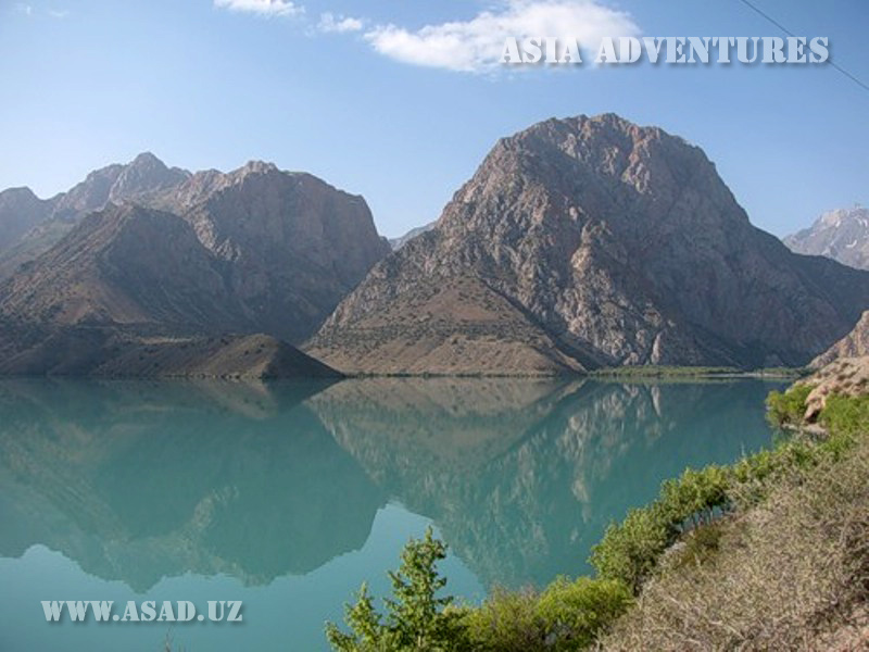
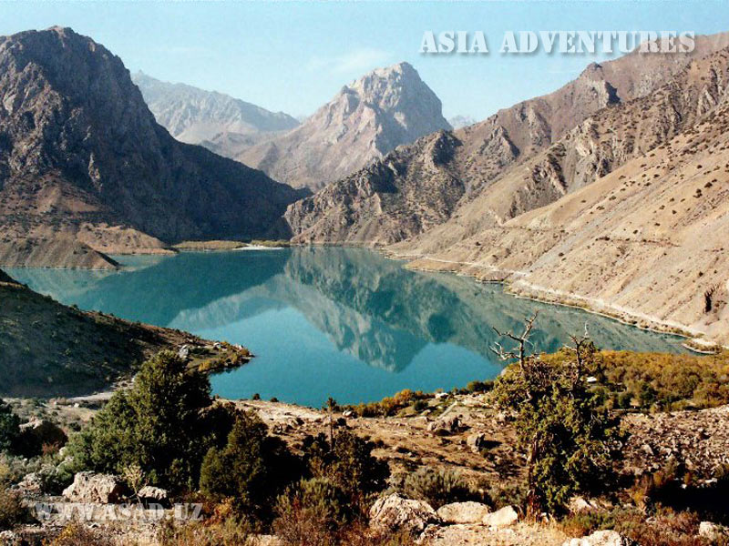
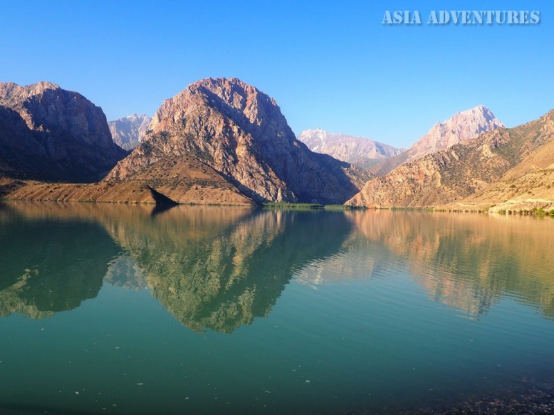
Iskanderkul (39° 4"17.17"N; 68°22"1.66"E) is the largest lake in the Fann Mountains situated at an elevation of 2,068 m above sea level. The reservoir has the form of an irregular triangle with rounded angles. It is 3.5 sq km in area and 72.0 m deep.
Lake Iskanderkul is a true pearl of the Pamir-Alai and is sometimes called the heart of the Fann Mountains.
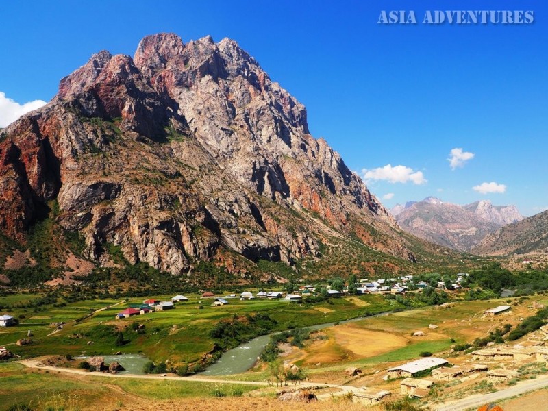
On all sides it is surrounded with huge rocky masses, which in some places form impregnable walls.
The highest peak in the area, Mount Kyrk Shaytan, rises to almost four kilometres above sea level. However, the other mountains in the neighbourhood are also higher than 3,000 metres, which means the difference in height between their summits and the lake’s surface exceeds 1 km. The turquoise of the water spectacularly contrasts with the red brown of the rock’s faces.
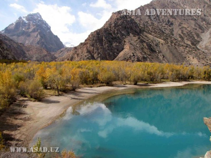
The rapid Sarytag, Khozormech and Serima Rivers flowing in wooded gorges and a talkative brook called Pescherny bring their cold waters into the lake. The sand and pebbles carried by the streams formed small flat grounds at each mouth, which are now covered with poplar, birch, aspen and juniper groves. The shore of Lake Iskanderkul is fringed with a narrow strip of willow, barberry, sweet briar and sea buckthorn shrubs. The bluish green water of the lake is quite cold, but it allows for swimming in closed bays and near the shore. In the winter Iskanderkul freezes all over, and only a current in the middle of the reservoir does not allow a small strip of water to become covered with ice. The lake area is inhabited by rock partridges, hoopoes and snowcocks. However, the lake proper cannot boast diverse fauna and is a home for only one small-sized fish species from the genus Salvelinus.
* * *
Lake Iskanderkul is wrapped in legends. According to one of them, Alexander the Great led his troops across the Fann Mountains, and while the army was camping on Iskanderkul’s shores, Bucephalus, the king’s favourite horse, sank in the waters. The name of the lake is also directly associated with the great conqueror, as Iskander was how the people in Central Asia pronounced the name Alexander.
Another legend tells how Alexander the Great conquered the rich lands of Sogdiana, a state that the present-day Iskanderkul Lake area once belonged to. However, the proud mountain dwellers did not wish to submit and were constantly disturbing the Macedonian army by delivering occasional unexpected attacks. Annoyed, Alexander ordered that the river with the Sogdian capital city on its banks be dammed, and the lake thus born buried forever the fortress and its brave defenders.
* * *
In fact, Lake Iskanderkul formed in an ancient glacial valley blocked by moraines and landslides. However, both the local people and tourists visiting the lake take more to one of the old legends than the dry lines of scientific reports. The captivating beauty of the lake and its surroundings easily sets a traveller to a poetic mood.
So what can attract tourists’ attention in the lake area?
One kilometre downstream the Iskanderdarya River flowing out of the lake drops into a narrow crevice from a forty-metre height. This powerful waterfall is often called locally ‘the Niagara Fall of the Fann Mountains.’
Next to Iskanderkul, in the Serima River valley, there is another beautiful lake, Zmeinoye (‘the serpent lake’), named so by travellers who often saw snakes swimming in it. Upstream the gorge narrows greatly and turns into a steep-walled canyon ending with another spectacular waterfall. However, to reach this one you will have to break through a thicket of wild cherry and other shrubs.
From the village of Sarytag on the left bank of the river with the same name you can take a path meandering between barberry shrubs and birch trees and get into the valley of the blue Arg River. Crossing the Sarytag River on a bridge upstream of the Sarytag village you will get to the Arg’s left bank, and if you take a bridge downstream of the village, you will soon find yourselves on the right bank of the Arg. The banks of the Arg with crystal blue water are covered with densely growing junipers, birches and barberries interspersed with rich meadows.
Those lovers of mountains and wildlife who, like the famous Russian poet, have ‘left their hearts in the Fann Mountains’ and wish to see something else apart from the inimitable beauty of the Iskanderkul Lake area, are offered a few interesting routes starting from the village of Sarytag.
A good path leads northwards, up the Arg River gorge. Beyond the far end of the gorge, at some distance, you can see the rocky bulk of Energia Peak (5,120 m), with the pointed summit of Chimtarga Peak (5,489 m), the highest point of the Fann Mountains, looking out from behind the former. As you walk on, moving from one bank to the other across a series of little bridges, you will soon see the first major gorge, in which the Southern Chapdara carries its waters. Further the path always tends to diverge from the river course climbing the slopes on the left bank, until it finally abandons this ravine and enters another one – that of the Biob River, with the Arg also seen foaming deep in a narrow crevice. The red rocks of Krasnye Zory Peak are visible in the upper stretch of the Biob. Crossing a bridge over the river you can climb onto a small piece of flat ground at the top of a natural dam. This place is called Teppa which means ‘a top.’ Below, on the right bank, upstream of the point where the Biob and Akhbasoy Rivers merge, there are a few flat patches of land climbers often use for camping. It normally takes about 8 hours to reach Teppa from Iskanderkul. If you continue northwards and cross the Kaznok Pass (4,040 m), you will get to Mutnye Lakes surrounded by formidable 5,000-metre peaks, or, if you walk even further along the Chapdara River valley, you will finally find yourselves on the shores of Lakes Alaudin with crystal clear water tinged with the whole range of turquoise and green playing in the sun.
Another interesting itinerary begins at the village of Sarytag and leads westwards across the Dukdon Pass (3,812 m) to the Archamaydan River valley and further across the Tavasang Pass to the inimitably beautiful Marguzor Lakes.
On the shore of Lake Iskanderkul there is a camping site built in the Soviet time, which, however, does not function properly nowadays. The visitors of the Fann Mountains will find it much more comfortable and attractive to stay in a guest house or a traditional Tajik house and acquaint themselves with ordinary Tajik people’s life tinged with oriental colours. As in all other regions across Central Asia, the local people are lovely and hospitable and always receive tourists cordially and with an open heart.
On the southern shore of Iskanderkul, at the mouth of the Sarytag River, there is the surprisingly modest country house of Tajikistan’s President with a helicopter landing ground at its side.
You can get to Lake Iskanderkul by car, either from Dushanbe (150 km) or from Tashkent across the Oybek border post (100 km + 310 km).
Iskanderkul lake photos