 Centralasia Adventures
+998712544100
Centralasia Adventures
+998712544100


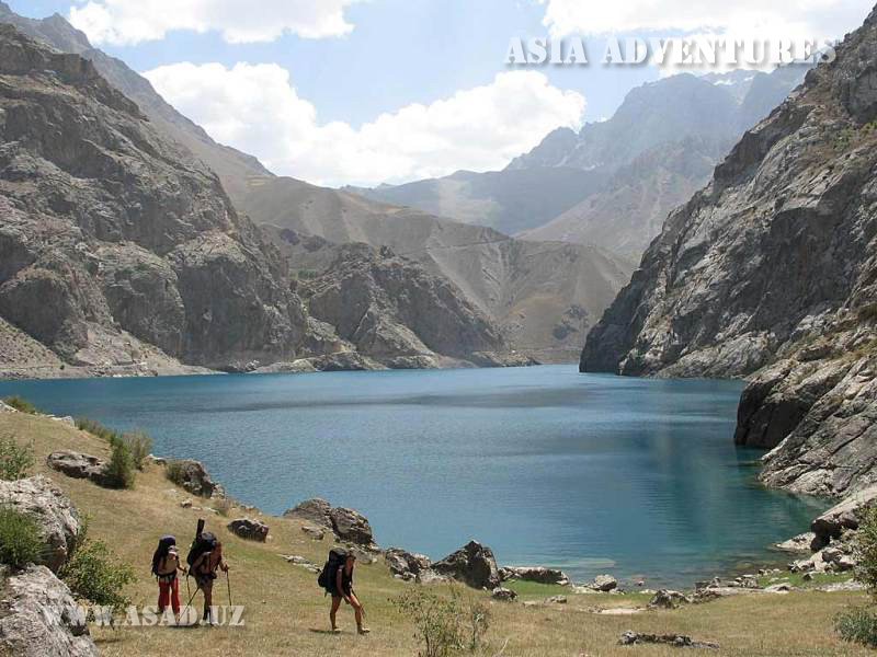
At the western extremity of the Fann Mountains there is a chain of seven lakes stretching along the Shin River valley, six of which were formed through obstruction of the stream, except for Lake Khazorchashma.
The entire system is called Marguzor Lakes, but each lake has its own name, too: Nezhigon (also Mizhgon), Soya, Gushor, Nofin, Khurdak, Marguzor and Khazorchashma. Often they are referred to by their numeric names, starting from the lowest: Nezhigon is the first, Soya is the second, Gushor is the third and so on. The difference in altitudes between the lowest and highest of the lakes is 692 m.
The first of Marguzor Lakes is Nezhigon situated at an elevation of 1,640 m (39°13"14.27"N; 67°48"2.07"E).
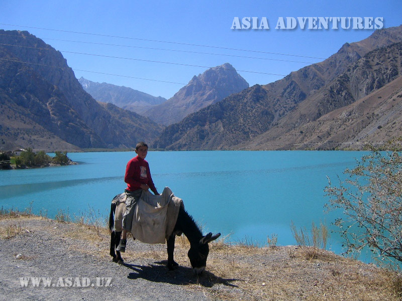
Nezhigon is a true pearl in the chain of lakes. Small and squeezed between steep walls, it has turquoise water, which, feeling a deep depression, seems immovable. The dome of a snow-capped mountain towering above the lake is surrounded with an aureole of soft multi-coloured shining. The water is quite warm and allows for swimming. Margozor Lakes, and particularly Nezhigon, are distinguished by unusual colours. The mineral substances dissolved in the water paint turquoise-blue both the lakes and the foamy Shin River. When the wild Shin slows and spreads into one of the lakes, the colour becomes deeper, from dark blue to violet. Beyond Nezhigon the road makes a few loops to climb onto a steep natural dam separating the first lake from the second one called Soya. The dam provides a marvelous view of Lake Nezhigon.
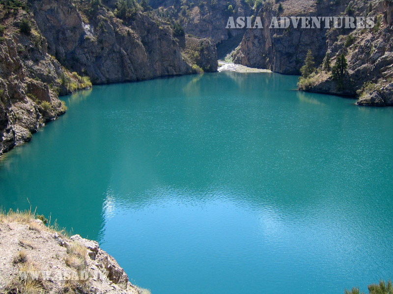
Soya, the second lake in the Marguzor chain, is situated at an elevation of 1,740 m above sea level (39°12"39.50"N; 67°48"15.16"E).
The water of Lake Soya is exceptionally beautiful. Its colour alters depending on the situation of the sun in the sky, ranging across all shades of blue to violet. The stones on the bottom are clearly visible even in deep places and also change their colours. ‘Soya’ translates as ‘shade’ and is called so because sunlight never touches its surface.
The third lake, Gushor (39°12"12.89"N; 67°48"40.13"E), is located 1 km from Lake Soya and 8 km from the village of Shin at an elevation of 1,770 m. Formerly, there was a camping site called Marguzor Lakes on one of its shores, but later it was swept by a mud flow. A number of climbing, trekking and cycling routes start from Lake Gushor.
Nofin, the forth lake situated at an elevation of 1,820 m (39°11"35.87"N; 67°49"22.92"E), is the longest in the chain with a length of 2 km and a width of 400 m. The road runs along the right shore of this lake with greenish water. Midway along the lake there is a small grove on the shore – a rare thing for the Shin River valley, as the mountains’ slopes and lake shores are rocky throughout and destitute of vegetation.
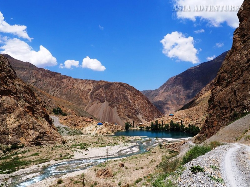
Lake five is called Khurdak and situated upstream of the village of Padrut at an elevation of 1,870 m above sea level (39°10"0.09"N; 67°50"17.41"E). The name translates as ‘little one’ and the lake is the smallest of the seven. Formerly, the water from the lake was used by a hydroelectric power station, which supplied electricity to a geological party and Padrut.
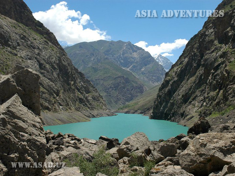
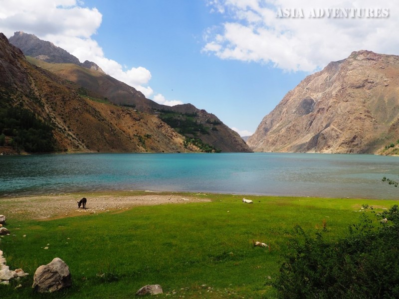
The flat area around the lake suddenly passes into the steep slope of a dam. The road serpentines up the dam for about 2 km to reach finally the sixth lake, Marguzor, at an elevation of 2,140 m (39° 8"45.21"N; 67°51"20.42"E). Lake Marguzor is rightly considered the most beautiful of the seven lakes, giving its name to the entire chain. Coming to the northern end of the lake, the road continues along its right (if you face downstream the Shin River) shore. The slopes surrounding Lake Marguzor are very steep, almost wall-like. With a length of 4.5 km and a depth of 45 m, Marguzor is the largest lake among ‘the seven beauties,’ as the lakes are often referred to. The colour of its water is delicate blue. A limestone boulder in the lake area has on it drawings by primitive people. There also are ruins of an ancient mineral processing plant, where you can easily gather a collection of stones of interesting and unusual colours. The northern slope of the dam behind Lake Marguzor is covered with a thick grove featuring high trees, sweet smelling grass and little streams finding their ways through the body of this natural obstruction.
The seventh lake, Khazorchashma, is situated at an elevation of 2,332 m above sea level (39° 6"23.20"N; 67°51"29.32"E). The lake does not form a part of the Marguzor system. Khazorchashma, the name of which translates as ‘thousand springs,’ is fed by a large number of springs and little streams rising from under the ground. There also are two rivers flowing into the lake – the Hissar and the Darakhti Surkh. Not far from the lake there is the Tavasang Pass. The lake area is covered with birch trees. The seeds of these trees are reported to have been sown by birds. Formerly, one of the branches of the Great Silk Road used to go past the lake.
Lakes Soya, Gushor, Nofin and Marguzor abound in fish. In early June the level of water is very low throughout the chain, and the lakes become full only by mid-July. As you drive upstream, the gorge becomes increasingly narrower, and it is hard to imagine what the paths along the shores had looked like before the road was constructed.
Lake Marguzor was also formed by a landslide. The road going along the lake’s right shore is cut in rocks. According to legend, when the world was very young, Allah sent his servants to cultivate the Earth, but the chain of Marguzor Lakes stopped them and did not allow them to beatify the gorge’s slopes with junipers and various fruit trees. That was why the young trees that had been meant for the Marguzor Gorge were planted in the next valley, Sarymat, whose slopes are covered thickly with orchards. To this day the inhabitants of the uppermost village, Tiogly, have to cross the Tavasang Pass and collect firewood in Sarymat.
A few popular tourist routes go across the Tavasang Pass (3,307 m): a path leads from the Marguzor Lakes to the Sarymat River valley and further along the Archamaydan valley and across the Dukdon Pass (3,812 m) to Lake Iskanderkul; another route runs along the Zindon River valley to lake Big Allo; or you can simply end your trip by going down along the Voru River valley to the village of Zimtut.
Marguzor Lakes photos