 Centralasia Adventures
+998712544100
Centralasia Adventures
+998712544100


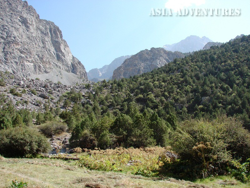
The Chukurak Gorge has in it three lakes, each beautiful and unique.
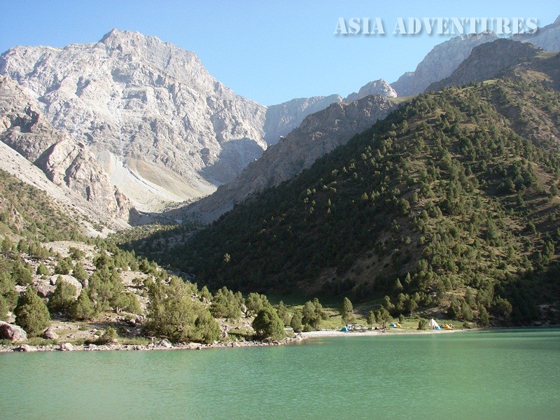
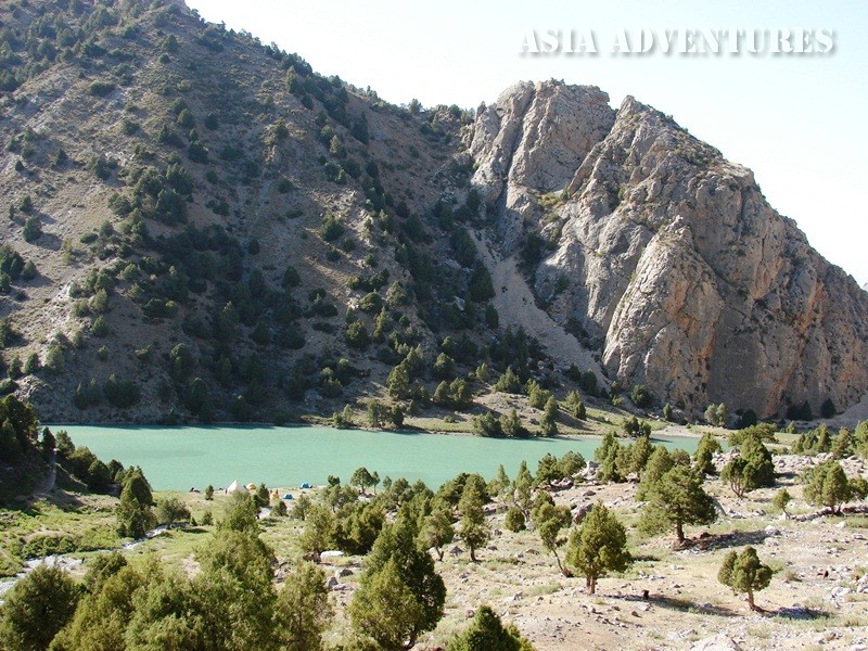
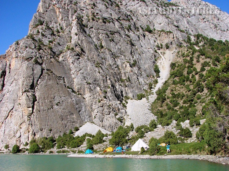
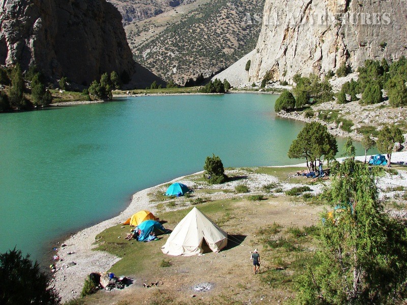
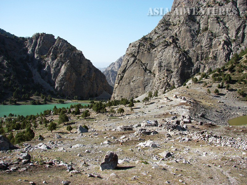
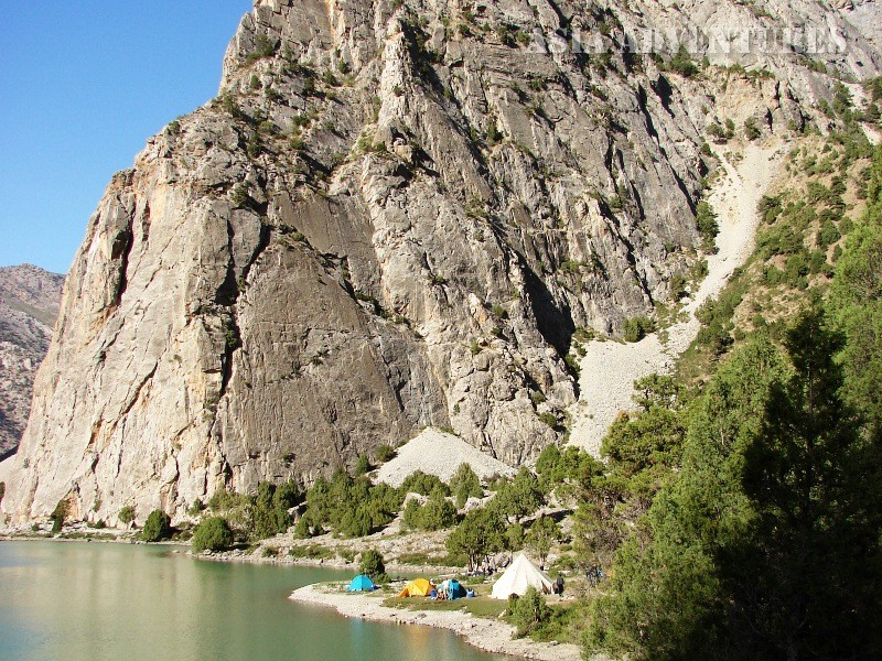
The lowest of them, Lake Chukurak (39°15"47.61"С; 68° 8"2.65"В), is located upstream of the mouth of the ravine blocking the way to the north (2,430 m). There, at the foot of a grandiose rocky fortress, under mountain slopes thickly covered with junipers, you can find an elongated lake, greenish in daylight and dark blue in the evening, which tends to turn into a carpet of tiny ripples whenever touched by a light wind. The lake is double, with the water cascading from the higher, larger part into the smaller one situated below the first. By late summer the flow in the feeding streams drops, and the larger lake shrinks considerably, while the lower one dries up completely. Three brooks carry water from snow patches above to the lakes. The streams grow weaker as the melting activity of the snow drops. The Chukurak River that flows out of the lake also becomes increasingly thinner until it disappears in the piles of rocks rising a little way downstream.
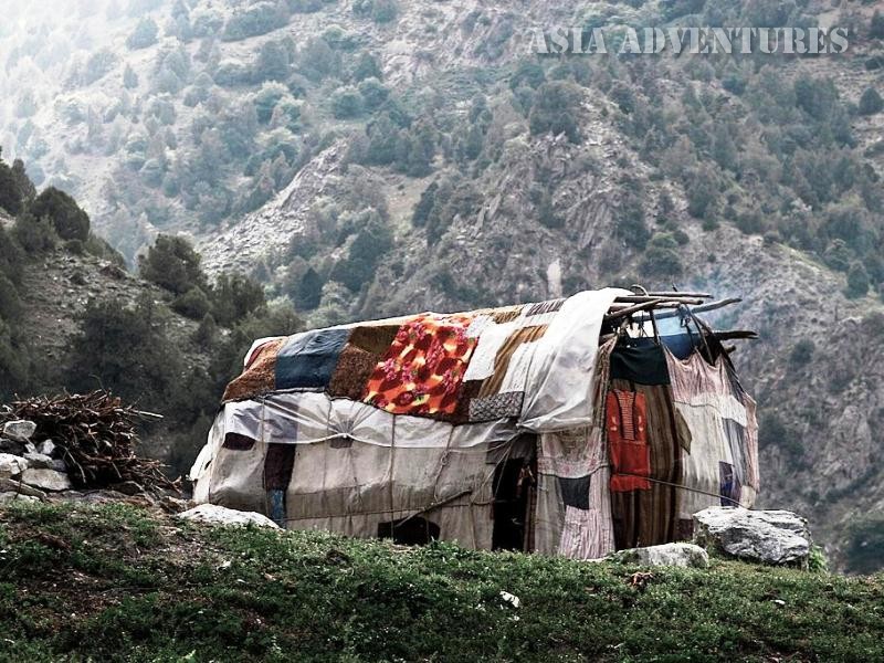
As you take the left-hand uphill path from Chukurak, you will soon get to a small lake called Beloye (White) (39°15"43.53"С; 68° 8"17.16"В), the area around which becomes covered with a coat of salt as the water level drops (2,480 m). This lake fed by a little stream running from the upper limits of the Chukurak Pass is endorheic (closed). It features a great variety of aquatic and wetland plants growing in it. You can see a spread of broad-leaved water lilies on its surface. The water is very warm, tastes of swamp and does not play in the sun.
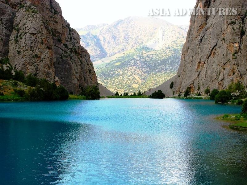
From Lake Beloye another path leads to Lake Ziyorat (39°14"50.23"С; 68° 8"16.29"В) lying to the south at an elevation of 2,790 m. The path first runs through the juniper forest, which gradually becomes thinner. The stream then hides under rocks, the light and broad tongues of screes going down to the path and the ragged tops of the ridges becoming increasingly closer and more accessible.
The lakes of the Chukurak Gorge are located at the junction of tourist routes.
To the east you can easily identify the saddle of the Chukural Pass (3,180 m); a good path goes diagonally westwards, across the Guytan Pass (2,640 m) to the picturesque village of Zimtut (10 km).
And just about 1.5 km north of Lake Chukurak there is the Artuch camp situated at 2,200 m above sea level, from which you can take wonderful one-day walks to the lakes.
Lakes of Chukurak gorge photos