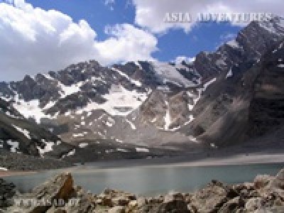
If we go to the south of Alaudin Lakes higher into the mountains, we can see the first moraine blocking the gorge. Its formidable crest consists of large blocks of rock, slabs and pillars. The easiest way to go round it is from the western side, where you can find some hints of a path under the wall of Adamtash. The last juniper grows under the first moraine. Lake Piala in the form of a regular bowl can be found glimmering right at the foot of the moraine at an elevation of 2,950 m (39°13"21.19"N; 68°14"55.80"E). A stream gushes from under a scree to call at the lake and then disappear under the rocks again. Only far down the slope the water finds its way to the surface and leaves the lightless dungeon for good.
The section between the second and third moraines is characterised by a vision of the dark silhouette of Fagitor’s summit. The third moraine is quite easy, and even a path can be seen here and there. A system of two lakes called Moutniye (turbid) can be found behind moraine fields above the third moraine at an elevation of 3,600 m above sea level (39°11"41.50"N; 68°14"11.39"E). The lakes, the water from which drins underground, were formed by the final moraine strengthened by landslides. The name ‘turbid’ is associated with the colour of the lake’s water filled with great numbers of suspended particles, which are brought from glacier beds by numerous streams. The landscape surrounding Moutniye can be characterised as austerely majestic. Unlike near Alaudin Lakes, there you will not find jolly meadows with beautiful flowers or sun-warmed forests. The area is overhung by rocks and glaciers where clouds drop tiny snowflakes and summits seem very near, and even the proud Chimtarga does not look so inaccessible. On the shore of the smaller lake there is a good piece of ground suitable for a camp. Despite the altitude the nights are not cold, while during the day you can even strip down to swimming trunks and sunbathe.
A number of interesting tourist itineraries include Lakes Moutniye.
You can trek southwards up onto the Kaznok East Pass (4,040 m), down to the Arg River and further to Lake Iskanderkul or the Archimaydan River valley.
To the west there is the Chimtarga Pass located between two 5,000-metre peaks, Chimtarga and Energia, at an elevation of 4,740 m. The way across this pass, which is high but quite easy from the technical aspect and offers a series of magnificent views, leads to Lake Big Allo.
Lakes Moutniye is a place revered by climbers. Zamok (‘Castle’) (5,070 m), Adiji (4,550 m), Zmeya (‘Snake’) (4,150 m), Fizkultury i Sporta (‘Physical Culture and Sports’) (4,120 m), Gratuleta (4,230 m), Chinal with the Fagitor spur (3,900 m), Paykhamber (4,958 m), Bodkhona (5,138 m), Politekhnik (4,400 m), Adamtash (4,580 m), Chimtarga (5,489 m), Energia (5,120 m) and Mirali (5,132 m) – this is but a short list of summits for which people from around the world arrive in the Fann Mountains.

 Centralasia Adventures
+998712544100


